The Continental Divide Trail (CDT) - Setting Out To Thru Hike

The Continental Divide Trail. Have you heard of it? You may well know that I’m just days away from starting to hike this epic route, but other than that what have I told you about it? Probably not enough. So here’s a brief introduction to the CDT, how I’ve prepared and what the next week might hold in my attempt to thru hike along this next great adventure.


I thought first that I would remind you about what a thru-hike is. It's a distance hike, along an established long-distance trail. You don’t have to start anywhere particular, although people often start at one end and hike to the other. Many start North, some South, and some jump on somewhere in the middle and ‘flip flop’ until they’ve covered the whole trail. The general perception is that if you hike the trail within one calendar year then that’s a thru hike, but I’m not crazy about purist rules and expectations. You’re hiking a long way - it’s hard and wonderful and awful and amazing and life changing. Do it however the heck you want to.
What is the Continental Divide Trail?

The Continental Divide sits as one of three ‘long trails’ in the USA that make up the ‘Triple Crown’ of hiking. These are the Appalachian Trail (2,200 miles), the Pacific Crest Trail (2,650 miles) and the Continental Divide Trail (anywhere between 2,800 and 3,100 miles). The mileage varies for the first two year on year as nature, wildlife and trail management means there are often re-routes. The mileage varies so much on the CDT because it’s the least well travelled, most remote and most open to interpretation and your own routing. There are heaps of alternates, high and low options and routes to avoid or see things of interest. You bet I’ll be taking some of those!
My Thru Hikes So Far
My experience of long trail thru hikes so far have been the Appalachian Trail Southbound, the South West Coast Path and the West Highland Way. Ideally I’d have the PCT in the bag too after getting my Southound permit last year but we all know that Covid is a gatecrashing, party pooping old bat, so that didn’t happen.
So, with travel opening up this year, I had a decision to make. The PCT? I decided not to. There was quite a bit of negative talk on the forums and socials over the last year about the permit situations - those that had bought them and lost them in 2020 then had to queue again and rebuy for 2021. People were a little heated.
Also, one of the biggest things that make a thru hike the magical experience it is are the trail communities along the way - the angels, the towns, the Zero days exploring said towns. This year I think it might be different and take a little while to recover. So, in case that’s correct, and whilst it happens, I decided to head to somewhere which automatically has less town exposure - the wild, long and very remote and challenging CDT.

Southbound on the Continental Divide!
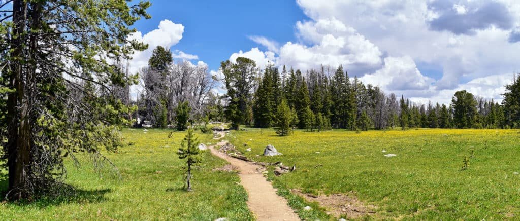
I’m attempting the CDT Southbound. In this direction it stretches from the Canadian Border in Montana through Idaho, Wyoming, Colorado and then New Mexico. There, it terminates at the Mexican Border some 3,100 miles later. It weaves through a wide and ever-changing environment; thought deserts, valleys, over high mountain ranges and across grassy tundra. The Continental Divide itself, which the trail more-or-less follows, is the watershed for the Americas. This means it’s a ‘hydrological’ divide. The water from one side eventually flows out to the Pacific Ocean out west. From the other, it makes its way eventually to the Atlantic Ocean in the east. The Continental Divide Trail follows the rough route of this Divide along a corridor of pathways that have, over years and with much effort from the CDT Coalition, been drawn together to make a thru route.

It’s still quite new as ‘long trails’ go, so it’s not all off-road yet. Sometimes the hike will be on well worn cattle paths, sometimes along dusty farmer roads to be able to check on their livestock, and often across nothing more than a whisper of a memory of a route across land barely trodden.
The remoteness is why I’ll be carrying a compass and referring to maps as well as my trusty GPS apps: Guthooks and Hiiker! It’s a pretty lonesome and dangerous place to be left with dead battery or a phone that falls down a ravine when you bend forward to look at something.
I'll be keeping you all in the loop
You’ll see the trail take shape as I hike. I'll post on my Instagram and also keep you updated through my weekly blogs. These will be first posted on Patreon to subscribers (thank you!!). Patreon will also be where I'll host regular live video calls from trail - woo hoo! Messy I'm sure, but real! A little later, the blogs will of course be here on my website too. The people, trials, tribulations and towns of this adventure will come alive for you as they reveal themselves to me. I can’t wait! But for now, what I can tell you is what the next few days have in store for me. On Sunday I leave Tulum for Cancun on the next stage of my long journey to get into the US.
How can I make the CDT happen with Covid restrictions?
Luckily I have a B2/B3 visa for the US which I got in order to hike the AT in 2019. This gives me up to 6 months in the US every time I visit. The visa lasts for as many visits as I need within 10 years! Of course, all within reason in the eyes of the border and customs control). I needed the B1/B2 because the ESTA, which most visitors, get is only for 3 months. That's not quite long enough for me to do a thru hike like the AT or CDT!
I’m very thankful I already have it, because due to Covid there is a halt on visa applications to the US Embassy. This makes sense as of course, UK visitors are not allowed to enter except if they have been out of the country (and Europe) for 14 days or more. So, visa in hand, here I am in Mexico, waiting 14+ days until I can get into the US.

I know this should work because when I was working in the Bahamas last Sept - Dec I was allowed into Atlanta, GA for the weekend because I’d been out of the UK for ages. Fingers crossed and all that!
What are my next steps for the Continental Divide Trail Thru?
Once I leave here, I fly to Seattle (Via Dallas I think!) and arrive late evening. The next day I have a few hours to grab a US sim card for my phone. I'll also get some things from REI - bear spray, maybe an ice axe and a few other bits and bobs. Then it’s on to my FAVOURITE! A sleeper train. The Amtrak sleeper goes from Seattle cross country.
I get off in Montana the next morning, where I'll meet the two awesome women I’ll be hiking with; Rocket and Little Skittle. We’ll chill in East Glacier for the day. Then we'll get to St Mary’s ranger station the next morning to wait for it to open. We need to get permits to hike through the first section in the park. The Rangers will be the ones to tell us where we can camp, and give us our permitted daily mileage. This'll be dictated by which campsites are available.
The park, like all US parks, is seeing unprecedented demand. Regulating campsites is a great way to help ensure the land and trails are protected from overuse. It’s brilliant, but it does make our planning a little impossible to sort out until we arrive! We know that however, and are will be ready to start walking as soon as we get a window. Hopefully that’ll be straight away but I’ll keep you posted!
I’m very excited, a little nervous of how out of shape I am, but generally raring to go. If you have any questions about prep please let me know below. I’ll be doing a post of all my gear on IG soon. Hopefully following up with a blog on here about it if I can!